Drone Services for Golf Courses
See Your Entire Golf Course in 15 Minutes
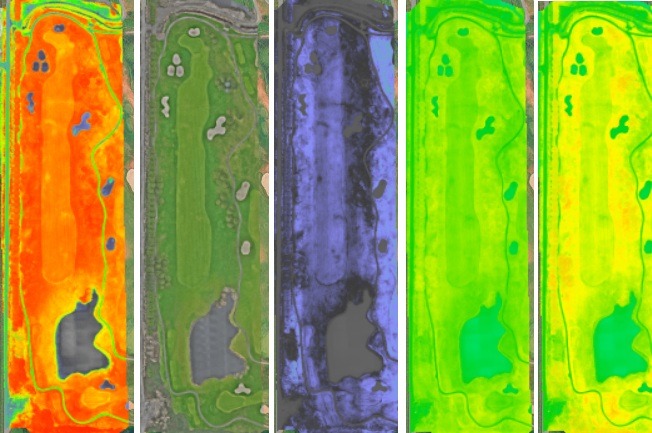
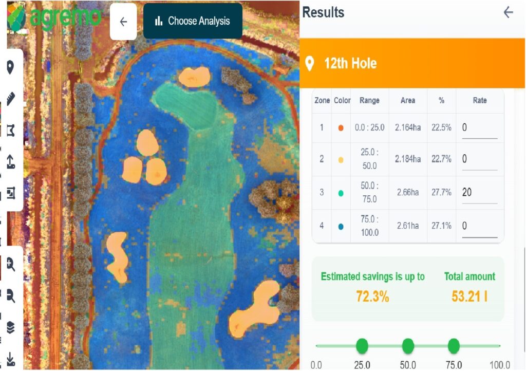
Drone services for golf courses starts with turf health mapping, irrigation diagnostics, and high-resolution imagery which help golf courses improve playing conditions and reduce overall operating costs.
What a 15-Minute Drone Flight Reveals
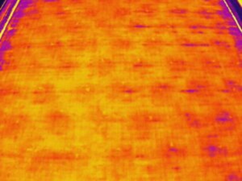
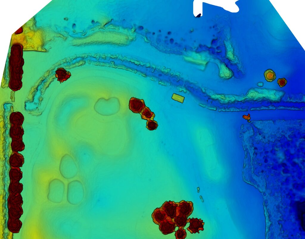
A single drone flight captures thousands of data points across your entire golf course delivering clear actionable insight into turf performance, irrigation efficiency, and surface conditions.
You Receive:
- High-resolution aerial map (full course)
- Turf health index maps (NDVI, NDRE, VARI)
- Irrigation performance analysis (thermal)
- Identified problem zones with GPS location
- A simple, actionable summary report
Turf Health Index Mapping
Multispectral Vegetation Analysis (NDVI / NDRE / VARI)
- Detects chlorophyll variation and early stress signatures
- Identifies nutrient imbalances across greens, fairways, and rough
- Highlights disease-prone or compaction-affected zones
- Tracks turf response over time for performance benchmarking
Health index layers allow superintendents to prioritize scouting and target interventions based on objective data rather than visual assessment alone.
Irrigation System Performance
Thermal & Coverage Analysis
- Identifies dry zones and uneven sprinkler distribution
- Detects malfunctioning heads, blocked nozzles, or pressure inconsistencies
- Reveals over-irrigation and water inefficiencies
- Supports optimization of run times and system zoning
Thermal mapping provides a rapid audit of irrigation uniformity across the entire course, which is particularly valuable during heat stress periods.
Surface Elevation & Drainage Modeling
High-Resolution Orthomosaic Imagery & Terrain Mapping
- Generates digital surface models (DSM’s)
- Identifies both high and low spots, as well as surface flow patterns
- Supports drainage improvements and contour planning
- Assists with bunker renovation and infrastructure upgrades
Accurate elevation data improves long-term drainage planning increasing overall course playability.
Why Golf Courses Use Drone Imagery
Drone analytics integrate directly into maintenance strategy by providing for:
- Targeted fertilization
- Precise irrigation adjustments
- Seasonal stress monitoring
- Compaction Management planning
- Budget-informed operational decisions
The result is greater turf consistency, improved resource allocation, and better playing conditions over time.
Get a Free Sample Golf Course Map
See exactly what drone data looks like before committing to a full service.
Offer Includes:
- Sample aerial map of the golf course
- Turf health (VARI) example
- Irrigation thermal example
- Report explaining the results