Agricultural Drone Mapping and Precision Application
See what’s happening across your fields, identify problems earlier, and apply inputs exactly where they are needed.
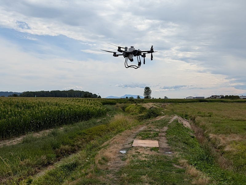
HiPics provides agricultural drone services throughout the Fraser Valley, combining advanced aerial mapping with targeted spray drone application.
High-resolution plant health imagery reveals variability across fields that may not be visible from the ground. These insights help growers detect stress earlier, respond faster, and apply fertilizers, biological products, or treatments precisely where they will have the greatest impact.
Field Variability Is Hard to See From the Ground
Most agricultural fields contain areas that perform differently.
Some zones may experience water stress, nutrient deficiencies, pest pressure, or drainage issues. These problems often develop gradually and may go unnoticed during normal field scouting.
By the time symptoms become visible at ground level, crop performance may already be affected.
Drone mapping using health indexes provides a clear aerial perspective of entire fields, helping growers identify patterns and problem areas early in the growing season.
A Smarter Approach to Field Management
Map Your Fields
Identify Stress and Variability
Apply Inputs Precisely
Drone mapping flights capture high-resolution aerial imagery and plant health data across entire fields or crop blocks.
This data reveals patterns in crop growth and highlights areas where plants are under stress.
Specialized plant health maps help identify areas affected by irrigation problems, nutrient deficiencies, disease pressure, or uneven growth.
These insights allow growers to focus attention where it matters most.
Spray drones apply fertilizers, biological products, or treatments to specific areas identified through mapping.
Both straight-rate and variable-rate application strategies are used to improve efficiency and reduce wasted inputs.
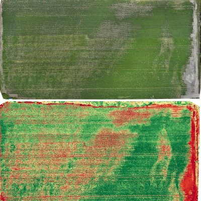
RGB Image
VARI Plant Health Index
Targeted Spray Application
Applications for Fraser Valley Agriculture
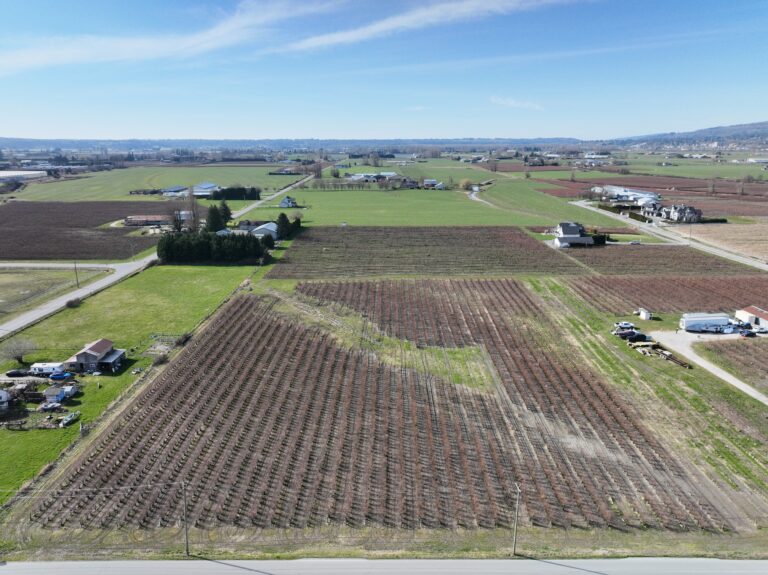
Blueberries
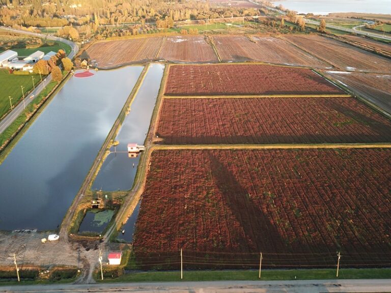
Cranberries
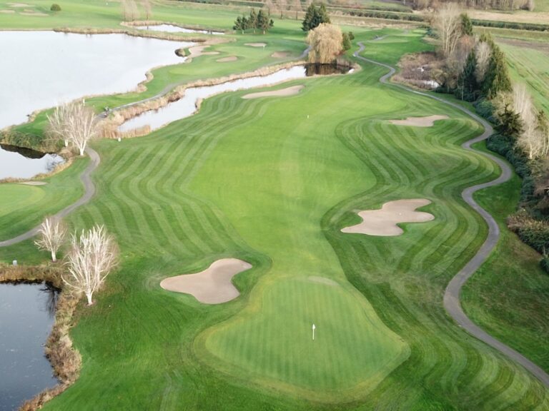
Forage, Vineyards & Turf
Drone mapping provides an efficient way to monitor blueberry fields for variability, irrigation issues, and early signs of plant stress.
Plant health imagery can highlight areas where bushes are underperforming, allowing growers to investigate problems and apply targeted treatments.
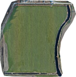
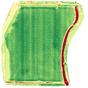
Large cranberry bogs can be difficult to monitor consistently from the ground. Drone imagery allows growers to survey entire bog systems quickly and identify uneven vine vigor or irrigation patterns.
This aerial perspective supports better decision-making throughout the growing season.
Drone imagery can also support monitoring of forage crops, vineyards, and managed turf such as golf courses.
High-resolution aerial imagery helps identify irrigation issues, uneven growth, and stress zones that may affect crop performance or turf quality.
Plant Health Mapping & Crop Monitoring
Multispectral drone sensors capture imagery that reveals subtle differences in plant health and vigor across a field.
These maps can highlight areas where crops may be experiencing stress related to irrigation, nutrients, soil conditions, or disease pressure.
Because drone imagery covers entire fields quickly, growers gain a complete overview of crop conditions rather than relying solely on spot scouting.
Regular monitoring flights throughout the growing season allow farmers to track changes and respond before small problems become larger ones.
RGB vs Multispectral Image
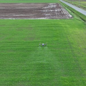
Precision Spray Drone Application
HiPics provides agricultural spray drone services for applying fertilizers, biological growth products, and crop treatments.
Spray drones allow inputs to be applied quickly and accurately across fields, including areas that are difficult to access with traditional equipment.
Using data from drone mapping flights, treatments can be applied using either straight-rate or variable-rate strategies depending on the needs of the crop.
This targeted approach helps reduce wasted inputs while ensuring that the areas requiring treatment receive the attention they need.
Benefits of Agricultural Drone Services
Identify crop stress earlier than traditional scouting
Monitor large fields quickly and efficiently
Reduce wasted fertilizer and crop inputs
Improve irrigation and field management decisions
Support more consistent crop performance across fields
Gain better insight into field variability
See What’s Happening Across Your Fields
Drone mapping and targeted spray application can help growers identify problems earlier, improve input efficiency, and support better crop performance throughout the growing season.
Contact HiPics to learn how agricultural drone services can support your operation.